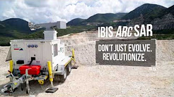
Hexagon Launches 3D Hazard Monitoring Tool
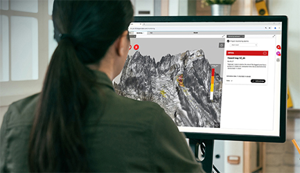
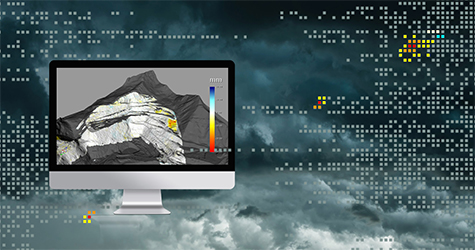
Hexagon has launched GeoMonitoring, a safety-critical, browser-based platform developed entirely by IDS GeoRadar. Designed to support the full monitoring cycle, the platform offers a collaborative 3D environment that enables technical teams to visualise and analyse ground instability and natural hazard data with clarity and precision. Its intuitive interface allows users across expertise levels to explore complex geotechnical information efficiently.
The platform integrates automated alerts, seamless data management, and multi-user project access with up-to-date IT security standards. These features facilitate the identification of displacement patterns and anomalies, promoting timely responses to potential safety incidents.
“GeoMonitoring is a growing platform built with users at the core. With its scalable software architecture, GeoMonitoring supports diverse projects from local-site to large-scale multi-site monitorings. Users can collaborate across workflows and benefit from optimised radar data management with leaner processes, advanced alarms management and fast access to data.” said Niccolò Coli, President, Radar & Monitoring, at Hexagon’s Geosystems division.
For more information
Categories: Geotechnical Services Safety - Equipment Slope Monitoring
2025-12-10 | IDS GeoRadar | Italy | Views 71
More from IDS GeoRadar